Dutchsinse Weather Predictions, New Madrid Watch

Moderators: Elvis, DrVolin, Jeff

Re: Dutchsinse Weather Predictions, New Madrid Watch

Postby seemslikeadream » Wed May 04, 2011 10:48 am

^^^^

you make me go back to the past, wonderful days, good day to die time. Robbie and the boys, the best there is


I know she's a tracker, any scarlet would back her
They say she's a chooser, but I just can't refuse her
She was just there, but then she can't be here no more
And as my mind unweaves, I feel the freeze down in my knees
But just before she leaves, she receives

She's been down in the dunes and she's dealt with the goons
Now she drinks from the bitter cup, I'm trying to get her to give it up
She was just here, I fear she can't be here no more
And as my mind unweaves, I feel the freeze down in my knees
But just before she leaves, she receives

It's long, long when she's gone, I get weary holding on
Now I'm coldly fading fast, I don't think I'm gonna last
Very much longer

"She's stoned" said the Swede, and the moon calf agreed
I'm like a viper in shock with my eyes in the clock
She was just there somewhere and here I am again
And as my mind unweaves, I feel the freeze down in my knees
But just before she leaves, she receives
Mazars and Deutsche Bank could have ended this nightmare before it started.
They could still get him out of office.
But instead, they want mass death.
Don’t forget that.
User avatar
seemslikeadream
 
Posts: 32090
Joined: Wed Apr 27, 2005 11:28 pm
Location: into the black
Blog: View Blog (83)

Re: Dutchsinse Weather Predictions, New Madrid Watch

Postby Canadian_watcher » Wed May 04, 2011 7:11 pm

I would have loved to have seen The Band live. Man.. what a ride that would have been!
Satire is a sort of glass, wherein beholders do generally discover everybody's face but their own.-- Jonathan Swift

When a true genius appears, you can know him by this sign: that all the dunces are in a confederacy against him. -- Jonathan Swift
User avatar
Canadian_watcher
 
Posts: 3706
Joined: Thu Dec 07, 2006 6:30 pm
Blog: View Blog (0)

Re: Dutchsinse Weather Predictions, New Madrid Watch

Postby 2012 Countdown » Wed May 04, 2011 8:21 pm

Well, thanks for the songs! haha...

So when I got home today, I walked down the street to the levee and took some photos and see for myself.
I also happen to have a few old photos of how the river is supposed to be normally for comparison. The river is high, but I think I'll be alright.
Lafayette I'd be more concerned about. Today on the news there was a slight escalation in coverage of Big Muddy's rise, but I'm still saying they are reporting it matter-of-factly.
Gov. Jindal flew over in a publicized photo op helicopter inspection of the levee system, so we should be fine here (whistles past graveyard).

Okay, this first one is for location. I am standing on top of the levee.
Image

===========

These are three old photos taken about a year or more ago.

Image
Image
Image

And back to ones today-

Image
Image
Image
Image
Image


They say in two weeks it will crest. Those photos should be fun!
George Carlin ~ "Its called 'The American Dream', because you have to be asleep to believe it."
http://www.youtube.com/watch?v=acLW1vFO-2Q
User avatar
2012 Countdown
 
Posts: 2293
Joined: Wed Jan 30, 2008 1:27 am
Blog: View Blog (0)

Re: Dutchsinse Weather Predictions, New Madrid Watch

Postby eyeno » Wed May 04, 2011 9:30 pm

Where are those pics taken 2012?
User avatar
eyeno
 
Posts: 1878
Joined: Wed Nov 24, 2010 5:22 pm
Blog: View Blog (0)

Re: Dutchsinse Weather Predictions, New Madrid Watch

Postby 2012 Countdown » Wed May 04, 2011 9:52 pm

Pics were taken on the west side of the Mississippi River, across from downtown New Orleans.
George Carlin ~ "Its called 'The American Dream', because you have to be asleep to believe it."
http://www.youtube.com/watch?v=acLW1vFO-2Q
User avatar
2012 Countdown
 
Posts: 2293
Joined: Wed Jan 30, 2008 1:27 am
Blog: View Blog (0)

Re: Dutchsinse Weather Predictions, New Madrid Watch

Postby eyeno » Wed May 04, 2011 11:06 pm

Decontamination Units Set Up In Marion Illinois After Levee Explosion

Reports show that a decontamination unit was set up in Marion Illinois to respond to flooding produced by the levee explosion on 05/02/2011. According to news reports a decontamination unit expects to be in the area for at least 7-10 days. MABAS sent its decontamination unit with two hazardous materials team members early Tuesday morning.

Here is a story coming from residents in the area.

My wife came home through Marion today after work and when she got home she told me what she had seen in Marion Illinois.. This was around 7pm tonight.

The National Guard or Army is set up at the old Wal Mart parking lot with 2 Decontamination units ( red trailers marked decontamination ) and they flood lights set up ( daytime so not in use ) and 7 other tents set up and equipment..

There were also police vehicles from Loves Park and Illinois state police , and a red semi trailer marked Illinois terrorist unit..
area was cordoned off where no civilians could enter. They have been there since last saturday and on the decontamination units were not there..

We wanted to verify the story, and found a news report of firefighters helping with flood recovery.

Local Firefighters Help with Flood Recovery
The immediate area is sending some equipment and manpower to southern Illinois in order to help aid in flood recovery there.

Galesburg Fire Chief Tom Simkins says firefighters Brock Schmitt and John Seitz took a decontamination unit from the local Mutual Aid Box Alarm System to Marion, Illinois, to used to help clean up first responders, National Guard members, and others helping clean up following the ongoing flooding in that area.

Simkins tells WGIL the request for help was made just Monday and coordinated very quickly.

"We got a call last [Monday] night, and it seems like they never give you a lot of lead time, but they asked if we would bring our decontamination unit down and be there by one o'clock [Tuesday] in Marion."

Simkins says the state is rotating four decontamination units in and out, and he expects Schmidt and Seitz to be gone seven to ten days, with all their expenses paid under the state disaster declaration made in that area.

The decon unit in question is typically housed with the Clover Township Fire Department in Woodhull.

http://lucaswhitefieldhixson.com/decont ... ay-03-2011
User avatar
eyeno
 
Posts: 1878
Joined: Wed Nov 24, 2010 5:22 pm
Blog: View Blog (0)

Re: Dutchsinse Weather Predictions, New Madrid Watch

Postby eyeno » Thu May 05, 2011 12:19 am

Something I found while poking around last night. Thought this was interesting, and dangerous as hell. I had no idea. I never realized that New Madrid was the spewing jugular vein of the nation for natural gas.

"You have four of the five major natural-gas pipelines come right through the soup in New Madrid, the soft alluvial soil," says Gray. "They carry gas all the way to Detroit, Chicago, Indianapolis and Pittsburgh. If (the earthquake) happened during the winter, you're going to have major-league problems on your hands. Try to explain to somebody why you cannot heat a nursing home or keep a hospital warm."
-- Ed Gray, Missouri State Emergency Management Agency (SEMA)
Riverfront Times


An earthquake in the middle of the country, along the precarious New Madrid fault, could have enormous fiscal and energy consequences. "Virtually every natural gas pipeline in the nation is built over that fault," Geller says. "You'll see the explosion reflected off the moon."
--insurancenewsnet.com


I don't know who this Geller guy is that wrote the above in blue but he gets style points for that quote.


Image
The main production areas and pipeline routes for natural gas (American Gas Association)


This site is a small motherload of New Madrid info. Very plainly laid out and uncomplicated to read. Tons and tons of graphics and charts about New Madrid.

http://showme.net/~fkeller/quake/maps3.htm
User avatar
eyeno
 
Posts: 1878
Joined: Wed Nov 24, 2010 5:22 pm
Blog: View Blog (0)

Re: Dutchsinse Weather Predictions, New Madrid Watch

Postby eyeno » Thu May 05, 2011 12:36 am


http://www.kspr.com/news/missouri/sns-a ... 3758.story
KSPR ABC 33

Christian County emergency response trailer stolen during flooding, contents dumped in Branson

By Associated Press

9:00 a.m. CDT, May 4, 2011

OZARK, Mo. (AP) — Christian County authorities are trying to find out who took the county's emergency response supply trailer during flooding in southwest Missouri over the weekend.

The white 14-foot Doolittle trailer was stolen Sunday evening as it was parked outside a warehouse in Ozark. It has a green "CERT" logo on the side. The contents were later found scattered along a road in Branson.

Phil Amtower, the county's emergency management director, says video surveillance shows a dark minivan parked near the trailer for several minutes. A white, late model single-cab pickup later arrives, hooks up the trailer and leaves with it.

The Springfield News-Leader reports that the trailer and training supplies were purchased through Homeland Security grants. The trailer is valued around $5,000.

___

Information from: Springfield News-Leader, http://www.news-leader.com
User avatar
eyeno
 
Posts: 1878
Joined: Wed Nov 24, 2010 5:22 pm
Blog: View Blog (0)

Re: Dutchsinse Weather Predictions, New Madrid Watch

Postby eyeno » Thu May 05, 2011 1:01 am

That seems like a big move even if it is for a whole state. Have no idea what it is about. Only thoughts come to mind would be privatization deal of some sort or anticipating needing the capacity due to the floods.

MoDOT director proposes to cut staff, close facilities to save $512M through 2015

By Associated Press

1:49 p.m. CDT, May 4, 2011
JEFFERSON CITY, Mo. (AP) — Missouri's transportation director is proposing to cut staff and close facilities to save several hundred million dollars to devote more resources to road and bridge projects.

Kevin Keith estimates his plan would save the Transportation Department $512 million through 2015. It calls for cutting 1,200 staff positions, closing 135 facilities and selling 740 pieces of equipment.

Keith presented the plan Wednesday to the Highways and Transportation Commission, which is expected to act on it at a June 8 meeting. If approved, the plan would be fully implemented by the end of 2012.

The changes are being proposed as Missouri has less money available for road construction. For the past five years, Missouri has averaged $1.2 billion for highway construction. However, that could be halved for the next five years.
http://www.kspr.com/news/missouri/sns-a ... 0672.story


Big money swapping hands lately.


Mo. Senate vote pass reauthorization of $450M of federal stimulus money
The Associated Press

8:34 a.m. CDT, May 4, 2011
JEFFERSON CITY, Mo. (AP) — The 20-8 roll call by which the Missouri Senate voted Wednesday to approve a budget bill reauthorizing the expenditure of about $450 million of federal stimulus money.

Voting "yes" were 16 Republicans and 4 Democrats.

Voting "no" were 7 Republicans and 1 Democrat.
http://www.kspr.com/news/missouri/sns-a ... 5001.story


“…a major quake along the New Madrid fault line could displace 7.2 million people and knock out 15 bridges. The response would require 42,000 first responders from local firefighters to the Pentagon. Another study by the Mid-America Earthquake Center last year estimates that nearly 750,000 buildings would be damaged, 3,000 bridges would potentially collapse…”

http://swittersb.wordpress.com/2011/03/ ... er-plants/
User avatar
eyeno
 
Posts: 1878
Joined: Wed Nov 24, 2010 5:22 pm
Blog: View Blog (0)

Re: Dutchsinse Weather Predictions, New Madrid Watch

Postby eyeno » Thu May 05, 2011 3:13 am

Florida has been hit with hurricane sinkhole", Sen. Garrett Richter

Posted by S.V. on May 4, 2011 at 7:30pm

Street Still Closed as Workers Fix Sinkhole
Could take 48 hours to fix broken pipe in Southwest Miami-Dade
Wednesday, May 4, 2011 | Updated 10:58 AM EDT

Image

Water pipes can cause sink holes but hard to call from this one article. But after reading the full page it looks more like an insurance bailout than a problem with fraud claims by homeowners. Second sink hole story I have seen today blamed on a busted water pipe. Yeah I know its the Zetas. I take what I can use and leave the rest.

http://poleshift.ning.com/profiles/blog ... n-hit-with
User avatar
eyeno
 
Posts: 1878
Joined: Wed Nov 24, 2010 5:22 pm
Blog: View Blog (0)

Re: Dutchsinse Weather Predictions, New Madrid Watch

Postby 2012 Countdown » Thu May 05, 2011 10:40 am

Geller says. "You'll see the explosion reflected off the moon."


That is a pretty sweet quote. You know, your 'spewing jugular vein of the nation' isn't bad either.

Whenever maps of this sort get posted, I can't help but think about the Cayce map of the future. In it, Louisiana and 2/3's of Florida are g-o-n-e.

Scares the crap out of me.
George Carlin ~ "Its called 'The American Dream', because you have to be asleep to believe it."
http://www.youtube.com/watch?v=acLW1vFO-2Q
User avatar
2012 Countdown
 
Posts: 2293
Joined: Wed Jan 30, 2008 1:27 am
Blog: View Blog (0)

Re: Dutchsinse Weather Predictions, New Madrid Watch

Postby seemslikeadream » Thu May 05, 2011 10:56 am

I wish Casey would have given a date for this

Image
Mazars and Deutsche Bank could have ended this nightmare before it started.
They could still get him out of office.
But instead, they want mass death.
Don’t forget that.
User avatar
seemslikeadream
 
Posts: 32090
Joined: Wed Apr 27, 2005 11:28 pm
Location: into the black
Blog: View Blog (83)

Re: Dutchsinse Weather Predictions, New Madrid Watch

Postby eyeno » Fri May 06, 2011 2:52 am

Musings of a madman... Eyes Wide Shut. The name of the person that sang much too much oh so too much, and told the main character that there was a secret meeting with an ever changing password, which led him to sneak in sex ball and get into trouble, had the name of "Nightingale".

Nightingale, the bird that sings too much and tells too much.

OBL who got him? "The tip of the spear", I heard it 20 times on mainstream if I heard it once.The underwater Navy Seals, who operated on dry land above water.

Bird's Point Levee. The very first blown when the river began to flood. "point" tip of a spear and its underwater.

TPTB hunt "birds", a well known fact, and term for sheeples that they use. I could say more but don't think I could verbalize it just now.

The biggest flood of this century, of the last five centuries says a hydrologist from the natural weather service, is chugging its way down the Mississippi and wreaking havoc in the middle of the country. The drill for this includes tens of thousands of people at the least. Not a whisper pretty much from mainstream media. All quiet. Not an accident, this silence....no singing on this.

The number of evacuees is beginning to run into the tens of thousands right about now. Its so quiet....

And it all started at Cairo...

And CNN said this was very similar to what happened in Pakistan last year...I swear they did.


Mississippi floods force evacuations near Memphis


By John Branston

MEMPHIS, Tenn | Thu May 5, 2011 10:23pm EDT

(Reuters) - The rising Mississippi river lapped over downtown Memphis streets on Thursday as a massive wall of water threatened to unleash near record flooding all the way to the Gulf of Mexico.

Water lapped over Riverside Drive and onto Beale Street in Memphis, and threatened some homes on Mud Island, a community of about 5,000 residents with a river theme park. The island connects to downtown Memphis by a bridge and causeway.

Emergency officials in Millington near Memphis were "going door-to-door, asking people to leave," according to the Tennessee Emergency Management Agency.

Large amounts of rain and melt from the winter snow has caused a chain reaction of flooding from Canada and the Dakotas through Illinois, Indiana, Missouri, Kentucky, Arkansas and Tennessee. It is expected to soon hit Mississippi and Louisiana at the mouth of the Mississippi River.

"The flood is rolling down, it is breaking records as it moves down and it is one of those wait-and-see type of things as to how massive it is going to be when it's all said and done," said Charles Camillo, historian for the Mississippi River Commission and the Mississippi River and Tributaries Project.

In Arkansas, westbound traffic on a section of one of the nation's major trucking arteries, Interstate 40, was closed for a second day due to flooding.

The White River was expected to crest at its highest ever level of 40 feet at Des Arc, Arkansas on Thursday night, breaking a 1949 record.

A levee overflowed near the White River, forcing a mandatory evacuation of the town of Cotton Plant, the Arkansas Department of Emergency Management said.

Officials at the Shelby County Office of Preparedness, that includes Memphis, predicted that the flood could affect 2,832 properties if it crests at 48 feet this coming weekend.

A crest of 48 feet would be the river's highest level since 1937, according to the National Weather Service. The service currently puts the river level at Memphis at 45.21 feet, with an expected rise to 47.6 feet by Monday morning.

The flooding is also affecting towns not directly on the Mississippi. Residents in south Dyersburg, Tenn., about 20 miles from the Mississippi, have been asked to evacuate because of the projected crest of the North Fork of the Forked Deer River, which runs into the big river.

North of Memphis upstream, the U.S. Army Corps of Engineers blew up a third section of a Missouri levee Thursday afternoon to let flood waters back into the Mississippi.

The Corps blew up a two-mile section of the Birds Point levee Monday night to help ease flooding in Illinois and Kentucky. The levee destruction resulted in the flooding of 130,000 acres of Missouri farmland. The Corps then blew up two smaller sections of the levee Tuesday and Thursday to let water back in the river.

President Barack Obama on Wednesday declared parts of Kentucky, Mississippi and Tennessee as disaster areas due to flooding. Missouri Governor Jay Nixon Thursday requested that Obama make a major disaster declaration for the state as a result of high winds, tornadoes and flooding since April 19.

The levee system in Mississippi is holding for now but it has never been tested like this before, officials said.

"Compared to the Great Mississippi Flood of 1927 this flood is going to be a lot nastier," said Marty Pope, senior hydrologist for the National Weather Service in Jackson, Miss.


The river is predicted to crest at 64.5 feet on May 17 in the Vicksburg, Miss. area. Vicksburg has a flood stage of 48 feet, which means the river will crest more than 16 feet above normal, according to flood experts at the National Weather Service.

The flood waters will reach more than a foot above the Yazoo Backwater Levee near Yazoo City, Miss. and this will flood thousands of acres of farmland, said Pope.

There were major floods on the Mississippi in 1927, 1937, 1973, 1993 and 2008. The 1927 flood caused up to 1,000 deaths and left 600,000 homeless. Floodways were adopted as a response.

Camillo said it was too early to estimate expected damage from the 2011 flooding. He noted that much has changed since the 1927 flood, including the structure of the levees and the addition of dozens of reservoirs throughout the Mississippi River basin and floodways.

The Mississippi has four floodways: Birds Point and three spillways in Louisiana.

"There is a very good possibility that we would operate three floodways ... and we have never done that before," Camillo said.

(Additional reporting by David Bailey in Minneapolis, Tim Ghianni in Nashville, Suzi Parker in Little Rock and Leigh Coleman in Biloxi, Mississippi; Writing by Mary Wisniewski; Editing by Greg McCune)


http://www.reuters.com/article/2011/05/ ... 2I20110506
Last edited by eyeno on Fri May 06, 2011 4:23 am, edited 1 time in total.
User avatar
eyeno
 
Posts: 1878
Joined: Wed Nov 24, 2010 5:22 pm
Blog: View Blog (0)

Re: Dutchsinse Weather Predictions, New Madrid Watch

Postby eyeno » Fri May 06, 2011 3:57 am

by The Associated Press
Published: Thu, May 05, 2011 - 6:36 pm CST Last Updated: Thu, May 05, 2011 - 6:55 pm CST
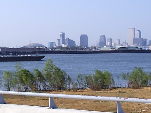
From Illinois to Louisiana, thousands evacuate amid fears of worst flooding in a century


Jail inmates filled sandbag after sandbag to protect one of the many Southern river cities threatened by the swelling Mississippi as it broke more 1930s flood records and crept higher Thursday.

In Missouri, the Army Corps of Engineers blew a third hole in a levee to relieve pressure and prevent catastrophic flooding there and in Illinois and Kentucky. The Mississippi continued to rise in Caruthersville, where a high-mark set in 1937 was surpassed on Wednesday, but was generally going down elsewhere in the state. The water was expected to crest Sunday in Caruthersville at 49.5 feet, just a half-foot below the top of the floodwall protecting the community of 6,700.

Thousands of people from Illinois to Louisiana have already been forced from their homes, and anxiety is rising along with the river, though it could be a week or two before some of the most severe flooding hits.

In Hickman, a town of about 2,500, Morrison Williamson was confident a towering floodwall would save his hardware store, despite small leaks that let some flood waters spray through.

Williamson was in a nearly deserted downtown, keeping his store open for customers who needed flood-fighting supplies. He said the decision to break open the Missouri levee upstream has kept the river from topping the floodwall, saving many communities to the south.

"They say blowing up the levee saved Cairo (Ill.) Well, it did. But if this breaks, you're talking Dyersburg, Ridgely, Tiptonville, water all the way to Memphis," Williamson said about places in neighboring Tennessee.

About 120 Fulton County jail inmate volunteers dressed in orange or white prisoner uniforms furiously filled sandbags for Hickman. They have made 120,000 since April 26.

"We're just going to keep going until they say stop," jail Sgt. James Buckingham said.

"I've never seen it this bad," said 78-year-old Joe Harrison, who has lived in the same house in Hickman since he was 11 months old. Floodwaters turned his house into an island — dry but surrounded by water. He has been using a boat to get to his car, parked on dry ground along a highway that runs by his house.

Tom Salem, a meteorologist with the National Weather Service in Memphis, said flooding is extreme this year in part because of drenching rain over the past two weeks. In some areas, Wednesday was the first day without rain since April 25.

"It's been a massive amount of rain for a long period of time. And we're still getting snowmelt from Montana," Salem said.

President Barack Obama on Wednesday declared parts of Tennessee, Mississippi and Kentucky disasters, making the states eligible for federal help with relief efforts.

Forecasters and emergency officials said some of the high-water records set during the great floods of 1927 and 1937 could fall.

But because of the system of levees and locks built since those disasters more than 70 years ago, flooding this time is unlikely to be anywhere near as devastating.

"We have a high confidence in our levees, but in the sense of transparency, we have to say that the levees have not been tested," Shelby County Emergency Management Director Bob Nations said in Memphis, Tenn.

The great flood of the lower Mississippi River Valley in 1927 was one of the biggest natural disasters in U.S. history. More than 23,000 square miles were inundated, hundreds of thousands of people were displaced and hundreds died.

The flood found its place in folklore, literature and films, and popular songs including "When the Levee Breaks."

More devastation came in 1937 when 31,000 square miles were submerged from West Virginia to Louisiana.

Lifelong Hickman resident H.L. Williamson, 77, was a boy when he and his family fled to the highest point in town. He recalled little except that his brother wouldn't eat black-eyed peas or grapefruit for years because that was all they had during the flood.

This time, Williamson packed up and left his home, which was still dry thanks to a hill just inches higher than the floodwaters. He took only a few belongings, including the Navy uniform he hopes to be buried in.

The relief from blowing up the levee is probably only temporary downstream in Kentucky, Arkansas, Tennessee, Mississippi and Louisiana because the water will eventually find its way back into the Mississippi River.

In Arkansas, a stretch of westbound Interstate 40 was closed where it crosses the White River, adding a 120-mile detour to the main route to Little Rock from Memphis. The state highway department said eastbound lanes remained open Thursday but flooding appeared imminent and they too could be shut.

Arkansas recorded its eighth death since the rains started April 25 when authorities found the body of a man in the floodwaters in eastern Arkansas' Prairie County.

In Kentucky, about 3,800 residents have left their homes.

Memphis, where the Mississippi was at 43.8 feet Tuesday, could see a crest of 48 feet on May 11, just inches below the record of 48.7 feet set in 1937. Water from the Wolf and Loosahatchie rivers already has seeped into the suburbs, and some mobile home parks were swamped.

Emergency management officials said more than 1,100 houses and apartments could be hit with flooding. Several hundred people have already left, and thousands more are expected to follow them.

In Louisiana, shippers, ports and the chemical industry hoped the government could dredge fast enough to keep a major channel into the Gulf of Mexico unclogged. The Mississippi sends huge amounts of sediment downriver during high-water times.

Because the maximum-security Louisiana State Penitentiary at Angola is particularly flood-prone, the state planned to evacuate the most medically vulnerable inmates by Monday, then others later.

Mississippi officials told about 1,000 people packed into a National Guard armory Wednesday that they are confident the main levees along the Mississippi River will withstand high water in the coming weeks, but they warned that some backwater levees could be overtopped by as much as a foot.

Mississippi Gov. Haley Barbour warned people to expect monumental flooding and said he was moving his furniture from his family's lakeside home to prepare for flooding from the Yazoo River.

With the recent deadly outbreak of tornadoes and, now, the threat of flooding, "we're making a lot of unfortunate history here in Mississippi in April and May," said Jeff Rent, a Mississippi Emergency Management Agency spokesman.

http://www.wkrg.com/weather/article/on- ... 1_6-55-pm/


Image
User avatar
eyeno
 
Posts: 1878
Joined: Wed Nov 24, 2010 5:22 pm
Blog: View Blog (0)

Re: Dutchsinse Weather Predictions, New Madrid Watch

Postby Peachtree Pam » Fri May 06, 2011 2:37 pm

Cross-posting from Fukushima thread:
http://blacklistednews.com/?news_id=13789&print=1


Nuclear plant workers release unknown amount of radioactive tritium into Mississippi River
May 6, 2011

By Ethan A. Huff - Natural News

Workers at the Grand Gulf Nuclear Plant in Port Gibson, Miss., last Thursday released a large amount of radioactive tritium directly into the Mississippi River, according to the US Nuclear Regulatory Commission (NRC), and experts are currently trying to sort out the situation. An investigation is currently underway to determine why the tritium was even present in standing water found in an abandoned unit of the plant, as well as how much of this dangerous nuclear byproduct ended up getting dumped into the river. Many also want to know why workers released the toxic tritium before conducting proper tests.

The Mississippi Natchez Democrat reports that crews first discovered the radioactive water in the plant’s Unit 2 turbine building after heavy rains began hitting the area last week. Unit 2 was a partially-constructed, abandoned structure that should not have contained any radioactive materials, let alone tritium, which is commonly used to manufacture nuclear weapons and test atomic bombs (http://www.nirs.org/radiation/triti…)

According to reports, alarms began to go off as workers were releasing the radioactive storm water into the river, which engaged the stop flow on the release pump. Neither NRC nor plant officials know how much tritium was released into the river during this release.

“Although concentrations of tritium exceeded EPA drinking water limits, the release should not represent a hazard to public health because of its dilution in the river,” insisted Lara Uselding, public affairs officer at NRC Region IV, to reporters.

Such a statement, of course, is a health concern because precise levels of released tritium are unknown. Just because the radioactive substance has been diluted does not necessarily mean it is harmless, nor does it verify the substance’s source or whether or not it is still being unknowingly released. Without this crucial information, there is no telling where else tritium might be lurking around the plant and river.

A beta radioactive substance, tritium bombards cells and damages DNA when inhaled or swallowed, and can persist in the body for more than ten years upon exposure. Its perpetual effect on cells can lead to all sorts of serious diseases, including, but not limited to, gene mutations, birth defects, and cancer.
Peachtree Pam
 
Posts: 950
Joined: Sat Jul 02, 2005 9:46 am
Blog: View Blog (0)

PreviousNext

Return to General Discussion

Who is online

Users browsing this forum: No registered users and 178 guests