Massive 1,100yr Maya site discovered in Georgia's mountians

Moderators: Elvis, DrVolin, Jeff

Massive 1,100yr Maya site discovered in Georgia's mountians

Postby seemslikeadream » Wed Dec 21, 2011 10:30 pm

Massive 1,100+ year old Maya site discovered in Georgia's mountains

Archaeological zone 9UN367 at Track Rock Gap, near Georgia’s highest mountain, Brasstown Bald, is a half mile (800 m) square and rises 700 feet (213 m) in elevation up a steep mountainside. Visible are at least 154 stone masonry walls for agricultural terraces, plus evidence of a sophisticated irrigation system and ruins of several other stone structures. Much more may be hidden underground. It is possibly the site of the fabled city of Yupaha, which Spanish explorer Hernando de Soto failed to find in 1540, and certainly one of the most important archaeological discoveries in recent times.

BLAIRSVILLE, GA (December 21, 2011) -- Around the year 800 AD the flourishing Maya civilization of Central America suddenly began a rapid collapse. A series of catastrophic volcanic eruptions were followed by two long periods of extreme drought conditions and unending wars between city states.

Cities and agricultural villages in the fertile, abundantly watered, Maya Highlands were the first to be abandoned. Here, for 16 centuries, Itza Maya farmers produced an abundance of food on mountainside terraces. Their agricultural surpluses made possible the rise of great cities in the Maya Lowlands and Yucatan Peninsula. When the combination of volcanic eruptions, wars and drought erased the abundance of food, famines struck the densely populated Maya Lowlands. Within a century, most of the cities were abandoned. However, some of the cities in the far north were taken over by the Itza Maya and thrived for two more centuries.

In 1839, English architect, Frederick Catherwood, and writer, John Stephens “rediscovered’ the Maya civilization on a two year long journey through southern Mexico. When their book on the journey was published in 1841, readers in Europe and North America were astounded that the indigenous peoples of the Americas could produce such an advanced culture. Architects in both continents immediately recognized the strong similarity in the architectural forms and town plans between southern Mexico and the Southeastern United States. Most agronomists were convinced that corn, beans and tobacco came to the natives of the United States and Canada from Mexico.

In the decades since Catherwood’s and Stephens’ book, archaeologists have not identified any ruins in the United States which they considered to be built by a people, who had originated in Mexico. This was primarily due to their unfamiliarity with the descendants of the Southeastern mound-builders . . . tribes such as the Creeks, Alabamas, Natchez, Chitimachas and Choctaws. In particular, the languages of the Creek Indians contain many Mesoamerican words.

Historians, architects and archaeologists have speculated for 170 years what happened to the Maya people. Within a few decades, the population of the region declined by about 15 million. Archaeologists could not find any region of Mexico or Central America that evidenced a significant immigration of Mayas during this period, except in Tamaulipas, which is a Mexican state that borders Texas on the Gulf of Mexico. However, Maya influence there, seemed to be limited to a few coastal trading centers. Where did the Maya refugees go? By the early 21st century, archaeologists had concluded that they didn’t go anywhere. They had died en masse.

The evidence was always there

In 1715 a Jewish lass named Liube, inscribed her name and the date on a boulder in Track Rock Gap. When Europeans first settled the Georgia Mountains in the early 1800s, they observed hundreds of fieldstone ruins, generally located either on mountaintops or the sides of mountains. These ruins consisted of fort-like circular structures, walls, Indian mounds veneered in stone, walls, terrace retaining walls or just piles of stones. Frontiersmen generally attributed these structures to the Indians, but the Cherokees, who briefly lived in the region in the late 1700s and early 1800s, at that time denied being their builders.

By the mid-20th century many Georgians held little reverence for Native American structures. Dozens of Indian mounds and stone masonry structures were scooped up by highway contractors to use in the construction of highways being funded by the Roosevelt Administration. Providing jobs and cheap construction materials seemed more important in the Depression than preserving the past.

During the late 20th century, the Georgia state government took an active role in preserving some of the stone ruins. Archaeologists surveyed a few sites. One of the better known ruins became Fort Mountain State Park. For the most part, however, the stone ruins remained outside the public consciousness.

In 1999 archaeologist Mark Williams of the University of Georgia and Director of the LAMAR Institute, led an archaeological survey of the Kenimer Mound, which is on the southeast side of Brasstown Bald in the Nacoochee Valley. Residents in the nearby village of Sautee generally assume that the massive five-sided pyramidal mound is a large wooded hill. Williams found that the mound had been partially sculpted out of an existing hill then sculpted into a final form with clay. He estimated the construction date to be no later than 900 AD. Williams was unable to determine who built the mound.

Williams is a highly respected specialist in Southeastern archaeology so there was a Maya connection that he did not know about. The earliest maps show the name Itsate, for both a native village at Sautee and another five miles away at the location of the popular resort of Helen, GA. Itsate is what the Itza Mayas called themselves. Also, among all indigenous peoples of the Americas, only the Itza Mayas and the ancestors of the Creek Indians in Georgia built five-side earthen pyramids as their principal mounds. It was commonplace for the Itza Maya to sculpt a hill into a pentagonal mound. There are dozens of such structures in Central America.

The name of Brasstown Bald Mountain is itself, strong evidence of a Maya presence. A Cherokee village near the mountain was named Itsa-ye, when Protestant missionaries arrived in the 1820s. The missionaries mistranslated “Itsaye” to mean “brass.” They added “town” and soon the village was known as Brasstown. Itsa-ye, when translated into English, means “Place of the Itza (Maya).”

Into this scenario stepped retired engineer, Cary Waldrup, who lives near Track Rock Gap. In 2000 he persuaded the United States Forest Service to hire a professional archaeologist from South Africa, Johannes Loubser, to study the famous Track Rock petroglyphs, and also prepare a map of the stone walls across the creek in site 9UN367. Waldrup and his neighbors felt that the stone structure site deserved more professional attention. They collected contributions from interested citizens in Union County, GA to fund an archaeological survey by Loubser’s firm, Stratum Unlimited, LLC.

Loubser’s work was severely restricted by his available budget, but his discoveries “opened up the door” for future archaeological investigations. His firm dug two test pits under stone structures to obtain soil samples. In conjunction with the highly respected archaeological firm of New South Associates in Stone Mountain, GA he obtained radiocarbon dates for the oldest layer of fill soil in a test pit, going back around 1000 AD. He also found pottery shards from many periods of history. Loubser estimated that some of the shards were made around 760 AD – 850 AD. This is exactly when Maya population began to plummet.

Loubser described the 9UN367 archaeological site as being unique in the United States, and stated that examples of such sites are only found elsewhere in the Maya Highlands and South America. However, he did not present an explanation for who built the stone walls. He was in a conundrum. The Eastern Band of Cherokees had labeled Track Rock Gap as a “Cherokee Heritage Sacred Site.” He had been led to believe that the area had occupied by the Cherokee Indians for many centuries, yet he also knew that the Cherokees never built large scale public works. In fact, the Cherokees established a handful of tiny hamlets in the extreme northeastern tip of Georgia during the 1700s, but the western side of Brasstown Bald Mountain, where Track Rock is located, was not official Cherokee territory until 1793.

Shared research between scholars

The People of One Fire is an alliance of Native American scholars (and their archaeologist friends) that was formed in 2006 after the Georgia Department of Transportation refused to retract a press release which blatantly contradicted several studies by nationally respected archaeologists. Much of its research has focused on tracing the movement of people, ideas and cultivated plants from Mesoamerica and Caribbean Basin to North America. By instantly sharing research rather than hoarding information, very rapid advances have been made in the past five years concerning the history of the indigenous people of North America.

People of One Fire researchers have been aware since 2010 that when the English arrived in the Southeast, there were numerous Native American towns named Itsate in Tennessee, Georgia, South Carolina and western North Carolina. They were also aware that both the Itza Mayas of Central America and the Hitchiti Creeks of the Southeast actually called themselves Itsate . . . and pronounced the word the same way. The Itsate Creeks used many Maya and Totonac words. Their architecture was identical to that of Maya commoners. The pottery at Ocmulgee National Monument (c 900 AD) in central Georgia is virtually identical to the Maya Plain Red pottery made by Maya Commoners. However, for archaeologists to be convinced that some Mayas immigrated to the Southeast, an archaeological site was needed that clearly was typical of Mesoamerica, but not of the United States.

In July of 2011, Waldrup furnished a copy of the 2000 Stratum Unlimited, LLC archaeological report to People of One Fire members. Those with experiences at Maya town sites instantly recognized that the Track Rock stone structures were identical in form to numerous agricultural terrace sites in Chiapas, Guatemala, Belize and Honduras. Johannes Loubser’s radiocarbon dates exactly matched the diaspora from the Maya lands and the sudden appearance of large towns with Mesoamerican characteristics in Georgia, Alabama and southeastern Tennessee. Track Rock Gap was the “missing link” that archaeologists and architects had been seeking since 1841.

Archaeologist have been looking for vestiges of “high” Maya civilization in the United States, when all along it was the commoners “who got the heck out of Dodge City” when wars, famines, droughts and almost non-stop volcanic eruptions became unbearable. The Itza Maya middle class and commoners became the elite of such towns as Waka (Ocmulgee National Monument) and Etalwa (Etowah Mounds) Just as happened in England after the Norman Invasion, the separate cultures of the commoners and nobility of the indigenous Southeast eventually blended into hybrid cultures that became our current Native American tribes.
Mazars and Deutsche Bank could have ended this nightmare before it started.
They could still get him out of office.
But instead, they want mass death.
Don’t forget that.
User avatar
seemslikeadream
 
Posts: 32090
Joined: Wed Apr 27, 2005 11:28 pm
Location: into the black
Blog: View Blog (83)

Re: Massive 1,100yr Maya site discovered in Georgia's mounti

Postby redsock » Thu Dec 22, 2011 7:28 pm

Extremely weak "evidence" - and no one else is reporting this finding.
User avatar
redsock
 
Posts: 204
Joined: Fri Nov 03, 2006 3:28 pm
Location: Ontario, Canada
Blog: View Blog (0)

Re: Massive 1,100yr Maya site discovered in Georgia's mounti

Postby MacCruiskeen » Thu Dec 22, 2011 7:52 pm

The evidence was always there

In 1715 a Jewish lass named Liube, inscribed her name and the date on a boulder in Track Rock Gap.


"Lass"?

Also, commas are not mere ornaments.

I gave up there.
"Ich kann gar nicht so viel fressen, wie ich kotzen möchte." - Max Liebermann,, Berlin, 1933

"Science is the belief in the ignorance of experts." - Richard Feynman, NYC, 1966

TESTDEMIC ➝ "CASE"DEMIC
User avatar
MacCruiskeen
 
Posts: 10558
Joined: Thu Nov 16, 2006 6:47 pm
Blog: View Blog (0)

Re: Massive 1,100yr Maya site discovered in Georgia's mounti

Postby seemslikeadream » Thu Dec 22, 2011 8:05 pm

it's just the beginning....so was continental drift theory in the early 1900's


maybe Alfred Wegener didn't use enough commas

I'm gonna buy the book in January and look at the 250 photos...I like pictures and commas


I hope there's enough comma's in this to justify reading :roll:

AN ARCHAEOLOGICAL AND ETHNOHISTORICAL APPRAISAL OF A PILED STONE FEATURE COMPLEX IN THE MOUNTAINS OF NORTH GEORGIA
Excerpts from an article by Johannes (Jannie) Loubser (Stratum Unlimited, LLC) and Douglas Frink (Worcester State College). From Early Georgia, Vol 38 (1), 2010. Thanks to Norman Muller for finding this.
Image
Here is a picture from Norman of one of the piles.
"A complex of piled stone mounds and walls, labeled site 9UN367, is located on a mountain slope 500 m southeast of the well-known Track Rock Gap petroglyph boulder complex (9UN3) in Union County of far northern Georgia (Figure 1). Both the stone feature complex and the petroglyph boulder complex are on land administered by the United States of America Department of Agriculture Forest Service. During an initial mapping of site 9UN367, Carey Waldrip and Jack Wynn (then of the Forest Service) identified a Lower and an Upper Concentration of stone features, although terraced walls link the two concentrations (Figure 2). Even though some of the stone walls and stone piles at 9UN367 resemble known historic period agricultural field clearing and terracing activities (see thorough overviews in Gresham [1990] and Ledbetter et al. [2006]), other stone features have no obvious analog in the historic record...."

The authors then go on to discuss all aspects of the history of the area, of the Cherokee, of the actual excavations. Accounts of the stone piles predate European occupation of the area.

"...For example, in 1834, a Doctor Stevenson observed “large and extensive heaps of loose rocks” (White 1854:658) near the petroglyph boulders. Some 37 years later, a Matthew Stephenson (1871:200) mentioned “extensive piles of rocks” near the same petroglyph complex. An 1832 land lottery survey map of Indian land in what was then Cherokee County, Section 1, District 17 (Torrence 1832) shows the Choestoe Indian trail running through the narrow gap, between the petroglyph boulders and the stone feature complex. Today the asphalted Track Rock Gap Road runs more-or-less along the same alignment as the ancient Indian trail..."
I think each dot on this map represent a sparate stone pile or short wall, but it is not clearly labeled. The similarity to some of our New England sites is clear.

"Traditions relate the stone feature near Yahula Creek to a Cherokee stock trader named Yahula, who conversed with the Immortal spirit beings from his isolated stone-walled enclosure. In both stories, the stone walls were places where these seers could view and even interact with spirit beings. The observation that these locales are located near creek heads conforms to the Cherokee conception of “the streams that come down from the mountains are the trails by which we reach this underworld [of the spirit beings], and the springs at their heads are the doorways by which we enter it” (Mooney 1900:240)."

"Even if the locale did not mark a battle site in one form or another, Cherokees nonetheless viewed stone pile concentrations of this nature with respect and trepidation. In a sense, ethnohistorically documented stone features are associated with the world of the dead below the ground."

The authors excavated in and around one of the stone walls and excavated a single rock pile. They were careful to keep track of how the rocks were removed and were able to replace them afterwards. They did dating:
"the wall was constructed during the latter part of the Etowah cultural phase (dating to between 1100 and 800 BP in the tentative chronology outlined by Cable and Gard 2000)."

Since some of the stone piles may be newer than others the picture above may not show a pile which is quite that old but still...

What struck me as the most interesting was the rock pile excavation. Here was what gets me going:

"Whereas the slabs along the edge of the pile mostly face up towards the center of the pile, those slabs closer to the center tend to face down. The downward facing slabs closer to the center of the pile create the impression of collapse or disturbance."

In other words they found what I call a "hollow". And what do you think they found inside?

"Excavation of Feature 1 and Stone Pile 1 was terminated as soon as prehistoric ceramics and lithics were recovered from the feature fill. The shape and dark coloring of the central Feature 1, together with a ceramic pipe bowl fragment recovered from within, strongly suggested that the feature represented a prehistoric Native American Indian grave. In compliance with NAGPRA and Georgia State laws concerning cemeteries, all work was terminated and the Forest Service was notified..."

During various excavations they found prehistoric stone flakes and ceramics as well as 1930 era ceramics. People from different time periods had interacted with the piles. The authors postulated picnickers.

Finally
"From the available evidence it appears that Stone Wall 13 probably dates to the Early Mississippian period and Stone Pile 1 probably dates to the Middle Woodland or Late Woodland/Early Mississippian periods. The proposed dates for these stone features are significantly younger than the so called “Hopewellian Period” (200 B.C. – A.D. 400)..."

The article includes many details, tables, and references. They mention other excavated stone mounds from Georgia and there being a mixture of modern and ancient, some containing human remains, others nothing. All in all it sounds just like up here in New England with the notable and exceptional difference: up here (with a few exceptions) the archaeologists do not have their eyes open.
Mazars and Deutsche Bank could have ended this nightmare before it started.
They could still get him out of office.
But instead, they want mass death.
Don’t forget that.
User avatar
seemslikeadream
 
Posts: 32090
Joined: Wed Apr 27, 2005 11:28 pm
Location: into the black
Blog: View Blog (83)

Re: Massive 1,100yr Maya site discovered in Georgia's mounti

Postby MacCruiskeen » Thu Dec 22, 2011 8:12 pm

maybe Alfred Wegener didn't use enough comma's

I hope there's enough comma's in this to justify reading :roll:


Alfred, Wegener knew how to use, punctuation lass. Maybe, thats why he was eventually taken, seriously. People could actually follow his argument's without suffering, migraine. attacks; Lass.
Last edited by MacCruiskeen on Thu Dec 22, 2011 8:16 pm, edited 1 time in total.
"Ich kann gar nicht so viel fressen, wie ich kotzen möchte." - Max Liebermann,, Berlin, 1933

"Science is the belief in the ignorance of experts." - Richard Feynman, NYC, 1966

TESTDEMIC ➝ "CASE"DEMIC
User avatar
MacCruiskeen
 
Posts: 10558
Joined: Thu Nov 16, 2006 6:47 pm
Blog: View Blog (0)

Re: Massive 1,100yr Maya site discovered in Georgia's mounti

Postby seemslikeadream » Thu Dec 22, 2011 8:15 pm

MacCruiskeen wrote:
maybe Alfred Wegener didn't use enough comma's

I hope there's enough comma's in this to justify reading :roll:


Alfreded, Wegener knew how to use, punctuation lass. Maybe, thats why he was eventually taken, seriously. People could actually follow his argument's without suffering, migraine. attacks. Lass.


Fucking only took 75 years !!!
Mazars and Deutsche Bank could have ended this nightmare before it started.
They could still get him out of office.
But instead, they want mass death.
Don’t forget that.
User avatar
seemslikeadream
 
Posts: 32090
Joined: Wed Apr 27, 2005 11:28 pm
Location: into the black
Blog: View Blog (83)

Re: Massive 1,100yr Maya site discovered in Georgia's mounti

Postby MacCruiskeen » Thu Dec 22, 2011 8:18 pm

"Here lieth the man who cured Hislop's lisp."

- Alasdair Gray.
"Ich kann gar nicht so viel fressen, wie ich kotzen möchte." - Max Liebermann,, Berlin, 1933

"Science is the belief in the ignorance of experts." - Richard Feynman, NYC, 1966

TESTDEMIC ➝ "CASE"DEMIC
User avatar
MacCruiskeen
 
Posts: 10558
Joined: Thu Nov 16, 2006 6:47 pm
Blog: View Blog (0)

Re: Massive 1,100yr Maya site discovered in Georgia's mounti

Postby seemslikeadream » Thu Dec 22, 2011 8:24 pm

MacCruiskeen wrote:"Here lieth the man who cured Hislop's lisp."

- Alasdair Gray.


just put your lips together Mac
Mazars and Deutsche Bank could have ended this nightmare before it started.
They could still get him out of office.
But instead, they want mass death.
Don’t forget that.
User avatar
seemslikeadream
 
Posts: 32090
Joined: Wed Apr 27, 2005 11:28 pm
Location: into the black
Blog: View Blog (83)

Re: Massive 1,100yr Maya site discovered in Georgia's mounti

Postby Stephen Morgan » Fri Dec 23, 2011 6:53 am

There doesn't seem to be any evidence to link any of this to the Mayans at all.
Those who dream by night in the dusty recesses of their minds wake in the day to find that all was vanity; but the dreamers of the day are dangerous men, for they may act their dream with open eyes, and make it possible. -- Lawrence of Arabia
User avatar
Stephen Morgan
 
Posts: 3736
Joined: Thu Apr 19, 2007 6:37 am
Location: England
Blog: View Blog (9)

Re: Massive 1,100yr Maya site discovered in Georgia's mounti

Postby seemslikeadream » Fri Dec 23, 2011 8:59 am

Stephen Morgan wrote:There doesn't seem to be any evidence to link any of this to the Mayans at all.


You got an advanced copy of the book? Please share some of the photos with me, please?
Richard Thornton has written a book on the Archaeological Site 9UN367 and the evidence of the immigration of Mesoamerican refugees to North America. It will be available from the publisher in early January 2012, and is entitled, “Itsapa . . . the Itza Mayas in North America.” The book includes over 250 full color, virtual reality images and photographs, including pictures of identical Maya agricultural terrace sites in Chiapas, Guatemala, Campeche and Belize. Indiana film maker, John Haskell is also producing a documentary film on the Maya diaspora.
Mazars and Deutsche Bank could have ended this nightmare before it started.
They could still get him out of office.
But instead, they want mass death.
Don’t forget that.
User avatar
seemslikeadream
 
Posts: 32090
Joined: Wed Apr 27, 2005 11:28 pm
Location: into the black
Blog: View Blog (83)

Re: Massive 1,100yr Maya site discovered in Georgia's mounti

Postby NeonLX » Fri Dec 23, 2011 9:01 am

Stephen Morgan wrote:There doesn't seem to be any evidence to link any of this to the Mayans at all.


Well, there was this, buried in the rubble somewheres:

Image
America is a fucked society because there is no room for essential human dignity. Its all about what you have, not who you are.--Joe Hillshoist
User avatar
NeonLX
 
Posts: 2293
Joined: Sat Aug 11, 2007 9:11 am
Location: Enemy Occupied Territory
Blog: View Blog (1)

Re: Massive 1,100yr Maya site discovered in Georgia's mounti

Postby seemslikeadream » Fri Dec 23, 2011 9:13 am

NeonLX wrote:
Stephen Morgan wrote:There doesn't seem to be any evidence to link any of this to the Mayans at all.


Well, there was this, buried in the rubble somewheres:

Image


That's bullshit... everyone knows the beginning of end of the world as we know it started on March 9, 2011...coincidentally the same day as the first earthquake in Japan.

Image
Mazars and Deutsche Bank could have ended this nightmare before it started.
They could still get him out of office.
But instead, they want mass death.
Don’t forget that.
User avatar
seemslikeadream
 
Posts: 32090
Joined: Wed Apr 27, 2005 11:28 pm
Location: into the black
Blog: View Blog (83)

Re: Massive 1,100yr Maya site discovered in Georgia's mounti

Postby seemslikeadream » Fri Dec 23, 2011 9:57 am

I guess, we should all stop looking now, everything that can be discovered, has already been discovered...end of story....period...nothing new here.... move along now

on edit, commas added for clarity, legitimacy, and of course, sincerity


17 lost pyramids found by satellite
Seventeen lost pyramids and more than 1,000 tombs have been found in a new satellite survey of Egypt.
17 lost pyramids found by satellite
Two new finds are at Saqqara, an older but lesser known pyramid site than Giza Photo: REUTERS
Rob Crilly

By Rob Crilly

1:43PM BST 25 May 2011

Scientists at the University of Alabama also found 3,000 ancient settlements using a new technique of infra-red imaging.

The astonishing results have been confirmed by archaeologists with picks and shovels, who have located two of the pyramids found from space.

"I could see the data as it was emerging, but for me the 'aha' moment was when I could step back and look at everything that we'd found,' Dr Sarah Parcak told the BBC.

"I couldn't believe we could locate so many sites all over Egypt."

The team analysed images from satellites orbiting 400 miles above the Earth, equipped with cameras so powerful they can pinpoint objects less than a yard in diameter.
Mazars and Deutsche Bank could have ended this nightmare before it started.
They could still get him out of office.
But instead, they want mass death.
Don’t forget that.
User avatar
seemslikeadream
 
Posts: 32090
Joined: Wed Apr 27, 2005 11:28 pm
Location: into the black
Blog: View Blog (83)

Re: Massive 1,100yr Maya site discovered in Georgia's mounti

Postby redsock » Fri Dec 23, 2011 2:12 pm

From the original post:
In 1999 archaeologist Mark Williams of the University of Georgia and Director of the LAMAR Institute, led an archaeological survey of the Kenimer Mound, which is on the southeast side of Brasstown Bald in the Nacoochee Valley. Residents in the nearby village of Sautee generally assume that the massive five-sided pyramidal mound is a large wooded hill. Williams found that the mound had been partially sculpted out of an existing hill then sculpted into a final form with clay. He estimated the construction date to be no later than 900 AD. Williams was unable to determine who built the mound.

Mr. Williams says this story "is not true. I have been driven crazy by this. ... The Maya connection to legitimate Georgia archaeology is a wild and unsubstantiated guess on the part of the Thornton fellow. No archaeologists will defend this flight of fancy."
User avatar
redsock
 
Posts: 204
Joined: Fri Nov 03, 2006 3:28 pm
Location: Ontario, Canada
Blog: View Blog (0)

Re: Massive 1,100yr Maya site discovered in Georgia's mounti

Postby seemslikeadream » Fri Dec 23, 2011 11:13 pm

The first "real" archaeologist to realize a direct connection between Mexico and the Southeast was Dr. Roman Piña-Chan, Director of the Museo Nacional de Antropologia de Mexico . . . and also one of the greatest archaeologists, who ever lived.


Román Piña Chan

Full name Ramon Pina Chan
Birth February 29 of 1920
San Francisco de Campeche , Campeche
Death April 10 of 2001
Mexico City
Occupation Archaeologist , anthropologist , researcher , historian
Nationality Flag of Mexico Mexico
Period XX and XXI centuries
Gender Archaeology , anthropology , history
Awards National Prize for History, Social Sciences and Philosophy ( 1994 )

Román Piña Chan ( San Francisco de Campeche , Campeche , February 29 of 1920 - Mexico City , April 10 of 2001 ) was an archaeologist and anthropologist Mexico .

Biography

Born in the district of San Roman, famous for the construction of merchant ships and fishing boats, Piña Chan studied in Campeche, and Industrial School in Mexico in the Vocational 4 of the National Polytechnic Institute .

Professor Emeritus of the National Institute of Anthropology and History , his studies of pre-Hispanic cultures, mainly the central and Gulf of Mexico, helped to characterize and stage periodization called the Preclassic and are seen in pre-classical cultures of Mexico Basin (1955 ).

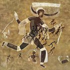
Her work in the enrichment of the past history was shocked at some 100 publications, among which Tlatilco (1958), Quetzalcoatl, the Feathered Serpent (1977), and culture and cities of the Maya (1959), which met a important research material.

He also studied at the National School of Anthropology and History with a specialty fellowship in physical anthropology, and later was in charge of the works for the National Museum of Anthropology .

The first meeting of what would be a fruitful career was on the practice field to Tzintzuntzan in Michoacan , led by Rubin de la Borbolla .

Henceforth not stop, then participated in the archaeological salvage work Chupícuaro , Guanajuato , where he remained for a long season. In Uxmal with Alberto Ruz, who led the field season, with the architect José Erosa Peniche, as well as the island of Jaina, Campeche, which led to several publications.

In 1949, the archaeologist returned to Mexico where he was commissioned to explore the cemetery Tlatilco, by Arturo Romano, by then, his passion for archeology and he was determined, but their studies. Subsequently be, Borbolla offered him a job for which Piña had to graduate. In 1951, Tlatilco experience, he did his thesis called The Valley Preclassic horizon Mexico and presented his exam.

His work was tireless, of the numerous works include the field of Chalcatzingo and Atlihuayán , in Morelos , that of Tlapacoya in Mexico; Comalcalco in the sale , and archaeological surveys in the basin of the Grijalva River in Tabasco , all it between 1945 and 1960. In the following decade Mulchic conducted archaeological work and the Cenote of Chichen Itza , in Yucatan , the Ventilla , in Teotihuacan , Mexico State , and Cuicuilco , south of Mexico City .

From 1970 and for 10 years, was responsible for project management and Huamanga Teotenango, both in the State of Mexico , later in Tingambaro, Michoacán, where he held the position of director of the Mexico-Michoacan Regional Center. From 1980-1984 he directed and coordinated the project Campeche, until Becán an unfortunate accident that occurred on September 13 his health dwindled significantly.

As a result of archaeological investigations conducted in Palenque , Bonampak , Jaina , Edzná , Chichen Itza , Uxmal and other Mayan sites in the region and ethnohistorical work relating to Quetzalcoatl, Tula and the Toltecs , the thesis published history, archeology and pre-Columbian art (1972).

Also, did important work in the branch of science and educational planning and counseling and conducting anthropological museums, among which the curator of the National Museum of Anthropology (Mexico) and renowned teaching career at the INAH and other institutions. Throughout his life shared his knowledge at various conferences around the Republic and in publications such as: "Chichen Itza, City water witches (1980)," cultural-historical Essay "(1960)," Bonampak "( 1961) and "Culture and cities Maya of Campeche "(1985), among others.

The archaeologist Roman Pina died of a stroke, April 10th of 2001 , the Hospital Angeles, in Mexico City . Since 1996, a Roman Piña Chan Symposium, as part of the Book Fair of Anthropology and History, seeking to lead and sustain pre-Hispanic cultures that support the country's history.
Works published

Piña Chan was an outstanding writer, and left printed in several books, specialized magazines and domestic and foreign fruit of long experience.

In the last two years of his life coordinated the historical encyclopedia of Campeche.

Maya cities (1958). National Institute of Anthropology and History. Mexico.
Tlatilco (1958). National Institute of Anthropology and History. Mexico.
Archaeological cities of Mexico (1963). National Institute of Anthropology and History. Mexico.
A vision of ancient Mexico (1967). Institute of Historical Research of the National Autonomous University of Mexico. Mexico.
Mesoamerica: The origins, cultures pre-classical, Teotihuacan, Toltec, Mexica, Oaxaca Cultures of the Gulf Coast, Maya, northern Mexico and western Mexico, Treasures from the National Museum of Anthropology. (1968). Daimon Mexicana, SA Mexico.
Campeche before the Conquest (1969). Publications of the State of Campeche. Mexico.
Some ideas about the figure of Valdivia (Ecuador) and the Olmecs (1971). Guayaquil. Journal of History and Archaeology. Mexico.
Teotenango. The ancient site of the walls (1975). Directorate of Tourism, Government of the State of Mexico. Toluca.
Quetzalcoatl Feathered Serpent (1977). Fondo de Cultura Económica. Mexico.
Chichen Itza: The city of the sorcerers of water (1980). Fondo de Cultura Económica. Mexico.
The cultures and Mayan cities of Campeche (1987). Editor of the Southeast / State Government * The language of stones (1992). Autonomous University of Campeche. Campeche.
The Mayan world of Campeche (1992). State Government of Campeche / PEMEX / INAH. Campeche.
The language of the Olmec and Zapotec glyph stones (1993). Fondo de Cultura Económica. Mexico.
The myth of Quetzalcoatl (1996). National Institute of Anthropology and History. Mexico.
Cacaxtla: historical sources and paintings (1999). Fondo de Cultura Económica. Mexico.

Awards and honors

Joaquín Baranda Award by the state of Campeche, in 1960.
Master Diploma tenured by the Universidad Iberoamericana .
Diploma scientific advice by the Museum of Cultures.
Gold Medal for academic services for the National Institute of Anthropology and History .
Silver Medal for services to the university community by the National Autonomous University of Mexico .
Son of the Ciudad del Carmen for their research and dissemination.
Silver Award Juchimán the Hispanic culture research by Universidad Juarez Autonoma de Tabasco .
Justo Sierra Medal for work in anthropology from the State of Campeche .
Diploma of Distinguished Founder of the Mexican College of Anthropologists.
Honorary Member of the Congress of Andean Culture Man and the Universidad Inca Garcilaso de la Vega of Peru .
Gold Medal by the National Institute of Anthropology and History .
Tlatilco Testimony by the City of Naucalpan .
Aztlan Award by the state of Nayarit .
National Prize for History, Social Sciences and Philosophy by the federal government of Mexico in 1994.
Recognition by the Autonomous University of Campeche .


People of One Fire


Kara Sundstrom:
The Mesoamerican connection: the Toltecs, artisans, scholars, priests and fearsome warriors
April 22, 8:44 PMArchitecture & Design Examiner
Richard Thornton

In the Examiner article on April 12, 2010, I discussed an initial meeting with the late Dr. Roman Piña-Chan, the internationally famous Maya archaeologist and Director of the Museo Nacional de Antropologia in Mexico City. He and Dr. Ignacio Bernal, Director of the INAH (Institutio de Anthropologia y Historia) in Mexico, had given me a tour of all seven floors of the museum. Each was given a book on the Southeastern Indians. The word, “Native American” didn’t exist back then! Dr. Bernal immediately left for his next appointment. However, as I was walking down the hall to my next appointment, a visit with Mexican architecture students, who were building models of early Maya cities, Dr. Piña-Chan called to me and waved his hand fore me to return. He had thumbed through the book I gave him, and become intrigued. He invited me back into his private office, and told his beautiful graduate assistant, Alejandra, to cancel the next appointment.

Dr. Piña-Chan was surprised that the Indians in Georgia created realistic marble and ceramic statues a 1000 years ago of people, who were dressed like Maya slaves and laborers. The turban was the badge of low social status among the Mayas, yet Creek leaders to this day wear turbans, not feathered head dresses. He then was impressed by the copper art produced at Ocmulgee and Etowah Mounds. He said it was superior to anything found in Mexico, but he was puzzled why the Southeastern Indians rarely worked with gold, since it was so much more malleable than copper.

The final surprise for the famous archaeologist was that while many aspects of the ancestral culture of the Creek Indians of the Southeast seemed directly tied to the Mayas, their architecture and two dimensional art was far more similar to that of the cultures east of Mexico City. He pulled several books off his library shelf on the Totonacs and Toltecs. Every glyph on the frieze of one temple at the Toltec Capital of Tollan, could be found on the pottery and copper art discovered at Etowah Mounds, GA. He then pulled down a book on the Anasazi Culture of the Southwest. Most of their two dimensional art also was similar to that of Central Mexico. At that point, I decided to spend more time than planned, studying the culture of the Toltecs and Totonacs!

Kara Sundstrom:
The Toltecs, what is known and not known

Despite the fact that the word “Toltec” is almost as well recognized as “Aztec” and “Maya” among laymen in the United States, much of their culture seems now to more of an enigma than ever. Many “facts” found in books published during the past fifty years, now have turned out to be questionable, or clearly not true. Anthropologists today are not even sure what ethnic group the Toltecs were . . . or if they were composed of several ethnic groups? The word “Toltec” roughly means “artists or scholars” in Aztec-Nahuatl. Anthropologists do not know if this is the name that the Toltecs called themselves.

After the decline and ultimate abandonment of Teotihuacan around 750 AD, nomadic Nahuatl-speaking peoples from northern Mexico migrated into the Central Highlands. The indigenous Otomi and Totonac Peoples were pushed eastward and southward. The ancestors of the Aztecs were among several Chichimeka tribes that occupied the Valley of Mexico.

Around 900 AD a major city was begun north of Mexico City in the State of Hidalgo that is now known as Tollan, or by its Spanish name of Tula. However, Tollan might not have even been its real name, because Tollan means “Place of Reeds” – the same name that the Mayas gave in their language to Teotihuacan. (See article on Teotihuacan.) “Place of Reeds” may have come to mean “major city or capital” in Mesoamerica.

The architecture of Tollan was much more geometric and symmetrical than typical Maya cities. It had a definite, masculine, martial feeling to it. Architectural styles were similar to those of Teotihuacan, but not at such a grand scale. There are several earthen pyramids in the United States which are larger than any of the pyramids built by the Toltecs. However, their temples were truncated rectangular pyramids that were similar in form to the earthen pyramids being built simultaneously in the Mississippi River Basin and Southeast. The central core of Tollan included rectangular plazas defined by both vertical landmarks and horizontal public structures. See the drawing above.

Kara Sundstrom:
One of the most vexing questions that archaeologists and architects have failed to resolve is the similarity between some principal structures at Chichen Itza and the major landmarks of Tollan. There are Temples of the Warriors in both Tollan and Chichen Itza. Both contain large temples on their tops, which were supported by massive stone statues of warriors. Yet, Chichen Itza also has many structures which were traditional Maya architecture, both in detail and form.

The Toltecs introduced several cultural practices, which later came to be associated with the Aztecs. The most notorious of these was the bloody ceremony in which priests held a victim on a stone alter and then cut out his or her heart. The hearts were then burned on a special alter dedicated to the god of war. This alter was called the Chac Mool by the Itza Mayas. Its Toltec name is not known. The Toltecs practiced several forms of human sacrifice that were associated with the worship of a pantheon of gods and goddesses.

The city of Tollan only lasted about 250 years. A combination of drought and constant assaults by less advanced Nahuatl tribes from the north, eventually triggered its collapse. Aztec histories state that Tollan’s first and last kings were named Quetzalcoatl (Quetzal bird – snake). The kings of the Toltecs were supposedly fair skinned and wore beards. The last Quetzalcoatl supposedly led his followers to the Gulf of Mexico from where they sailed to an eastern land. Hernando Cortes heard of this legend and initially fooled the Aztecs by pretending to be the god Quetzalcoatl, who had finally returned from the east.

Kara Sundstrom:
Tamaulipas

Tamaulipas State is located in the northeastern corner of Mexico and shares the Rio Grande border with Texas. Its aboriginal inhabitants, known as Tamauli, were few in number when the Spanish conquered the region, and soon became extinct. Virtually nothing is known of their ethnicity, language or history. Recent archaeological excavations of caves in Tamaulipas suggest that the indigenous people there began cultivating maize and squash as early as 1300 BC, but they continued to live in caves for another 1000 years. Caves were very practical habitats in the hot, dry climate of the region.

Records of the Aztecs, plus some archaeological evidence suggest that the Tamauli came under increasing influence and military pressure from the Toltecs during the period when Tollan was occupied. Subsequently, Huastecs from the south pushed into the coastal areas while Nahuatl speakers pressed from the west. Where the displaced Tamauli people went is unknown and subject to speculation. The Nahuatl form of Tamauli was Tamautli. Both ethnic names were used in both regions.

That the aboriginal people of Tamaulipas and the inhabitants of southeastern Georgia during the era of Spanish colonization had the same name is obvious. The question of whether they were one and the same ethnic group has never been researched.

Kara Sundstrom:
Possible evidence of contacts between the Toltec culture and the native peoples of North America

The Toltecs were confirmed land-lubbers. It is unlikely that Toltec trading or military expeditions reached the Southeastern United States, but possibly, some expeditions may have followed the shores of the Gulf of Mexico into the Mississippi River Basin, or penetrated far enough into what is now the Southwestern United States to reach the Anasazi in Chaco Canyon, New Mexico. However, as mentioned in the article on the Putan Maya, the Yokat’an towns and merchants in what is now southern Vera Cruz State, were greatly influenced by the Toltecs, to the point that their language essentially became a dialect which mixed Nahuatl, Zoque and Maya. Vera Cruz Putun ships were quite capable of reaching the mouth of the Mississippi River, and are documented to have regularly traded with the Huastec occupants of Tamaulipas on the southern side of the Rio Grande River.

It is quite common for text books to describe a vast no-man’s land in southern Texas, where no maize, beans or squash were grown. However, this was no real barrier to the Chontal merchants, since they typically traveled by boat when possible. With good winds, a Putun sea craft with oarsmen and a sail could have traveled from the Huastec towns in Tamaulipas to the southern boundary of “Mississippian Culture” in about two days.

An archaeological conference at Harvard University in 1947 decided that advanced indigenous cultures in the Southeast was an offshoot of the first advanced cultures in the Mississippi River Basin, just north of the Mason-Dixon Line. All advanced indigenous cultures in both regions were then labeled “Mississippian Cultures.” However, as earlier articles in this series pointed out, the earliest societies to show “all Mississippian cultural traits” were in southern Florida near Lake Okeechobee – and about 300 years earlier than when they appeared near the conjuncture of the Mississippi and Ohio Rivers.
Mazars and Deutsche Bank could have ended this nightmare before it started.
They could still get him out of office.
But instead, they want mass death.
Don’t forget that.
User avatar
seemslikeadream
 
Posts: 32090
Joined: Wed Apr 27, 2005 11:28 pm
Location: into the black
Blog: View Blog (83)

Next

Return to General Discussion

Who is online

Users browsing this forum: No registered users and 10 guests